
PFAS Contamination in the U.S. – Interactive Map
PFAS Interactive Map
from the Environmental Working Group, a non-profit, non-partisan organization dedicated to protecting human health and the environment.
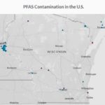 Open the website and click on each dot to get more information.
About the Map
PFAS Contamination in the U.S.
For water systems that had one or more detection of PFOS, PFOA or another contaminant, an average was calculated using the all samples collected. Samples with no detections were treated as zero when calculating the average, which in turn may skew the value lower when the contaminant is more common.
All locations represented on the map are approximate, and meant to visualize the general area of a contamination site or public water detection. Locations were mapped using the best available data preserved in official records, including data provided by tests of public drinking water systems, the Safe Drinking Water Information System, the Department of Defense report “Addressing Perfluorooctane Sulfonate (PFOS) and Perfluorooctanoic Acid (PFOA),” and the Northeastern University Social Science Environmental Health Research Institute.
Levels listed are for the range of the total of all PFAS detected at the time of the tests and do not reflect whether a water system is treating the water to reduce levels.
Data on contaminated industrial and military sites was current as of October 2019.
Disclaimer: EWG and the Social Science Environmental Health Research Institute (SSEHRI) at Northeastern University have worked to ensure the accuracy of the information provided in this map. The map is dynamic. This contaminant site, results, suspected sources, and other information in the database may change based on evolving science, new information, or other factors. Please be advised that this information frequently relies on data obtained from many sources, and accordingly, EWG and SSEHRI cannot guarantee the accuracy of the information provided or any analysis based thereon.
The PFAS map is provided solely for your personal, non-commercial use. It is meant to help Americans make informed choices about their health and environment. Please be advised that any and all information EWG and SSEHRI make available through the database is for general informational purposes only and is not intended as, nor should ever be considered a substitute for, professional medical advice. You can find EWG’s full terms and conditions here. To request permission to use the EWG-curated PFAS data, please e-mail this form to pfasdatarequests@ewg.org. The PFAS Contamination Site Tracker records complied by SSEHRI are available here.